
Right across the river
One of Chattanooga's oldest places is hiding in plain sight.
Moccasin Bend is the broad peninsula wrapped by the Tennessee River immediately west of downtown Chattanooga. From Point Park, it is one of the most recognizable shapes in the valley. Down at ground level, though, it can feel strangely separated from the city by Stringers Ridge and the river. [2]
That separation has helped preserve something unusual. The National Park Service calls Moccasin Bend one of the most important and concentrated archaeological assemblages of Southeastern American Indian cultures known in the Tennessee River Valley. The landscape preserves evidence associated with Archaic, Woodland, Mississippian, and earlier periods.[1][8]
In 2003, Congress added the district to Chickamauga and Chattanooga National Military Park specifically to preserve, protect, and interpret its nationally significant archaeological and historic resources. [7]
The part that is easy to missThis is not mainly a Civil War site.The Civil War occupies a few years of a story measured in millennia.
A very compressed timeline
Twelve thousand years in eight stops
The archaeological record reaches back to the Paleo-Indian era. Current NPS material describes roughly 12,000 years of American Indian presence on the peninsula.
Communities used the river valley's resources over thousands of years, with increasingly established settlement patterns and sophisticated stone-tool traditions.
This is one of the best represented periods on the Bend. Archaeological work has identified roughly twenty village sites associated with Woodland occupation.
Agriculture expanded, mound-building societies developed across the Southeast, and Moccasin Bend remained part of a much larger cultural and trade landscape.
Archaeology documents Spanish contact in the region. NPS notes that the exact expedition associated with Hampton Place remains uncertain.
Cherokee removal routes crossed and passed around Moccasin Bend. The Brown's Ferry road trace preserves a physical part of that forced removal.
Union forces occupied positions on the Bend, used artillery against Confederate positions, and moved badly needed supplies through the Brown's Ferry corridor on the Cracker Line.
Congress added Moccasin Bend National Archeological District to Chickamauga and Chattanooga National Military Park to preserve and interpret its nationally significant resources.
The dates above are broad archaeological and historical periods, not neat handoffs from one people or culture to another.[1][8]
Long before Chattanooga
The river is the reason people kept coming back.
Chattanooga exists where it does because geography matters, and that was true thousands of years before there was a Chattanooga.
Moccasin Bend offered access to the Tennessee River, fertile bottomlands, fish, game, plant resources, travel routes, and a defensible landscape. Archaeological evidence shows that people repeatedly lived, gathered, traveled, farmed, and built communities here across enormous spans of time.[1][8]
The Woodland period is especially well represented. NPS says excavations have identified roughly twenty village sites on the Bend. Later Mississippian communities were part of a regional world built around agriculture, trade, kinship, political organization, and mound-building traditions found across the Southeast. [1]
The park also preserves evidence of Spanish contact in the 1500s. NPS has historically identified either the Hernando de Soto expedition in 1540 or Tristan de Luna's expedition in 1560 as possible contacts with people living at Hampton Place, while treating the exact identification as uncertain.[1]
One road, several very different stories
Brown's Ferry Road is where the layers become visible.
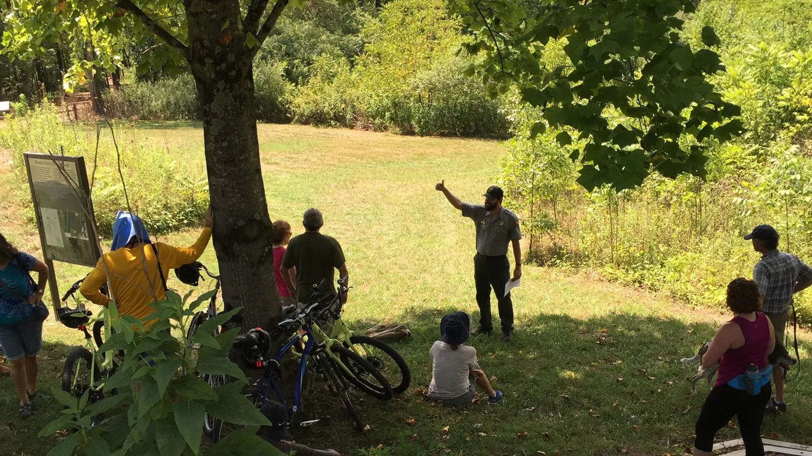
The Brown's Ferry Federal Road trace may be the best place for a visitor to understand how many different chapters of history overlap here.
The road connected Ross's Landing and regional travel routes with a ferry crossing on the Tennessee River. John Brown, a Cherokee man who held land and operated the ferry, benefited from the growing trade moving through the corridor.[3]
The same road also sits inside the history of American slavery. NPS research documents enslaved people living on and moving through Moccasin Bend. One surviving story follows Nelly, an enslaved woman who escaped from a traveling party near Brown's Ferry in 1818. The road later became an active route in the antebellum slave trade. [1][6]
Then came 1838. Cherokee people were forcibly removed from their homelands under U.S. government policy. Groups leaving the Chattanooga area traveled around Moccasin Bend by water, while overland removal also crossed the Bend along the Brown's Ferry corridor. Today that route is part of the Trail of Tears National Historic Trail. [1][3]
Twenty-five years later
The same corridor helped break the siege of Chattanooga.
By the fall of 1863, Chattanooga was a strategic Civil War prize and Union forces inside the city were struggling with a badly constrained supply line.
Union troops occupied Moccasin Bend and positioned artillery along Stringers Ridge, where batteries exchanged fire with Confederate positions on Lookout Mountain. More importantly, Brown's Ferry became part of the route that allowed supplies to reach the besieged Union army. That route became famous as the Cracker Line. [1][3]
It is hard to find a better Chattanooga example of landscape shaping history. The same bend in the river that supported communities for thousands of years also controlled where roads crossed, where people were forcibly marched, where armies put artillery, and where food could reach soldiers trapped inside the city.
Why archaeology changes how you visit
A lot of the important stuff is supposed to stay invisible.
This is not a historic site where the main resources are reconstructed buildings and monuments. Much of what makes Moccasin Bend nationally important is underground.
That is why the archaeological district can look understated. A field may contain traces of a village. A low rise may preserve cultural deposits. An old roadbed can carry multiple stories separated by centuries. Preserving the context around an artifact is often more valuable archaeologically than the object by itself.
So this is not a place to wander around looking for arrowheads or souvenirs. Stay on designated public routes, leave archaeological material where it is, and treat the landscape itself as the resource being protected. The entire reason the national archeological district exists is preservation.[7]
Visiting Moccasin Bend
The public side is intentionally pretty simple.
An open meadow overlooking the Tennessee River and one of the district's three primary public-access areas.[1]
About 1.2 miles round trip on an original historic road trace. NPS lists the trail as open from 6 a.m. to sunset.[3][4]
A roughly two-mile loop through forest and wetland areas created in part by twentieth-century river dredging, with a Tennessee River overlook. [5]
Current NPS visitor information does not list a dedicated Moccasin Bend visitor center, and NPS education guidance notes that the site lacks picnic areas, restrooms, and other visitor services. The main park visitor centers are at Chickamauga Battlefield and Lookout Mountain.[9][10]
Why the designation matters
This was the first national archeological district.
Moccasin Bend had already been recognized as a National Historic Landmark archaeological district before Congress folded part of the peninsula into the national military park in 2003. NPS planning documents describe the resulting unit as the nation's first national archeological district.[8]
That sounds like bureaucratic trivia until you look at what the designation is protecting: one landscape where thousands of years of Indigenous life, European contact, forced removal, slavery, Civil War logistics, archaeology, and a modern city all physically overlap.
NPS also emphasizes that Moccasin Bend retains profound cultural importance for contemporary American Indian tribes with ancestral ties to this area. This is not simply a story about vanished people in the distant past. [8]
Quick answers
Moccasin Bend FAQ
Is it 10,000 years or 12,000 years of history?
Both numbers appear in park materials from different periods. Current NPS pages describe approximately 12,000 years of American Indian occupation or presence on Moccasin Bend. So the "10,000 years" phrase is a useful headline, but the current archaeological interpretation reaches farther back. [1][2]
Is Moccasin Bend part of a national park?
It is a unit of Chickamauga and Chattanooga National Military Park, managed by the National Park Service. Congress created the National Archeological District unit in 2003. [7]
Can you walk the Trail of Tears route?
You can walk a preserved portion of the Brown's Ferry Federal Road trace associated with Cherokee removal. The NPS trail is about 1.2 miles round trip and includes interpretive exhibits. [3][4]
Is there an entrance fee?
No. NPS currently lists all Moccasin Bend National Archeological District sites as free. [10]
Can you collect artifacts at Moccasin Bend?
No. Archaeological resources in a National Park Service unit are protected. Leave artifacts and features where they are and stay on designated public routes.
The takeaway
Chattanooga grew up beside a place that was already ancient.
That is what makes Moccasin Bend different from a lot of local history sites. It is not one battlefield, one building, or one event. The river kept drawing people to the same landscape across thousands of years, and each era left something behind.
The modern city now sits right beside it. Downtown towers, highways, hospitals, a golf course, industrial infrastructure, forest, archaeological sites, old road traces, and the Tennessee River all exist in the same view.
Moccasin Bend is not a piece of Chattanooga's history sitting outside the city. It is part of the reason there is a Chattanooga here at all.